These satellite data products are currently not working. Use the Volusia AVHRR SST Summer Composite for now.
Latest Volusia AVHRR SST Summer Composite Image
These satellite data products are currently not working. Use the Volusia AVHRR SST Summer Composite for now.
This satellite data product is updated daily around noon local time but includes SST data from 2 nights ago. So it is not as recent as other images. It's a composite of satellite images from several satellites creating a cloud free image. This unfortunately means edges are not as sharp and recent anomalies may not show up like it would on other products.
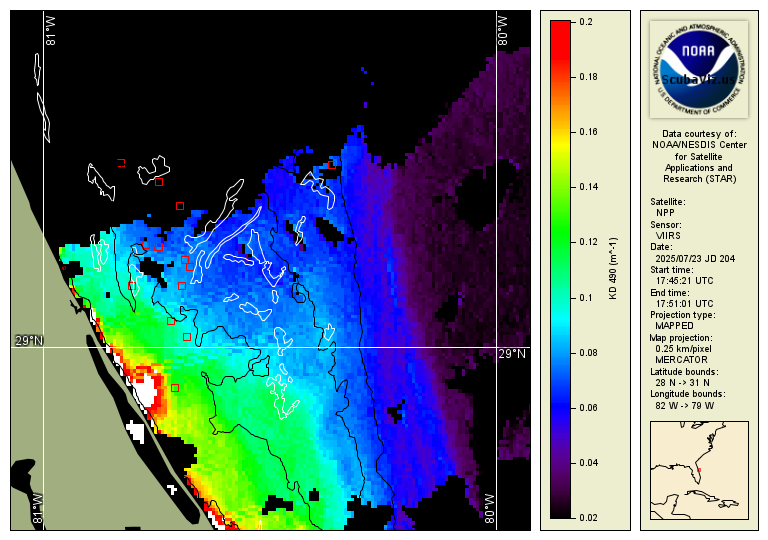
Latest Image
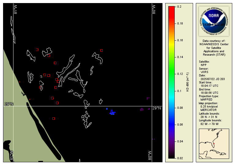
Previous Image
This page is a test for a new visualization format that will use Google Maps to display the image.
Google Map Test 29